
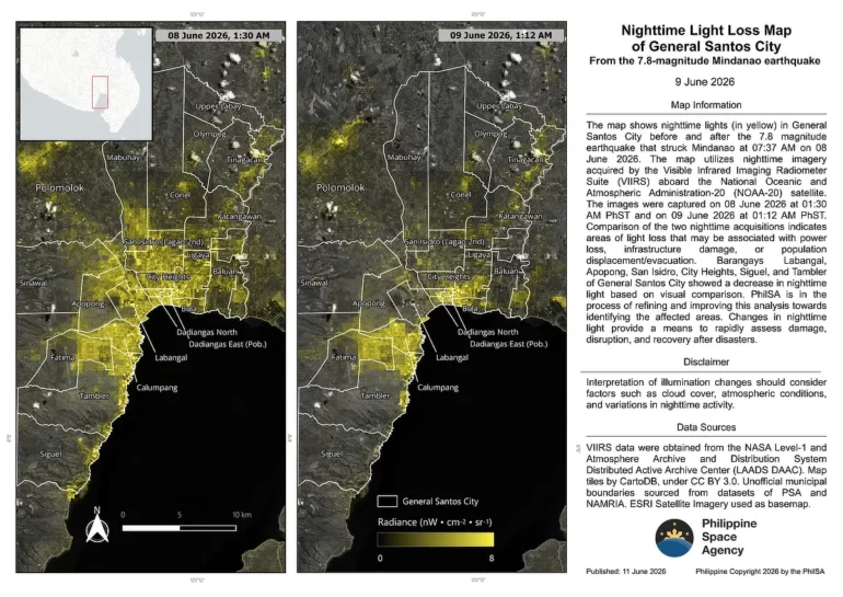
The Philippine Space Agency (PhilSA) released nighttime satellite data showing how the 7.8‑magnitude earthquake that struck Mindanao on June 8, 2026, affected local communities. The analysis compares satellite images before and after the quake to identify areas that lost power or suffered infrastructure damage.
Images captured on June 8 (1:30 AM) and June 9 (1:12 AM) reveal several areas with reduced nighttime light, a sign of disruption or evacuation. PhilSA said these changes help provide a quick overview of affected zones and support disaster response planning.
The data highlights barangays Labangal, Apopong, San Isidro, City Heights, and coastal areas Siguel and Tambler in General Santos City, showing significant light reduction.
Coastal municipalities Maasim and Glan in Sarangani, and Polomolok in South Cotabato, also recorded lower nighttime brightness, indicating possible power loss or infrastructure impact.
PhilSA’s preliminary analysis offers a visual snapshot of where the most severe effects occurred, helping responders prioritize recovery efforts. The agency continues to monitor post‑quake imagery to track restoration progress and community recovery.
Also Read: Globe, Smart, PLDT, DITO keep Mindanao connected after quake
Satellite‑based light data is now a useful tool for assessing disaster impact, especially when ground access is limited. For Mindanao, it gives a clearer picture of how quickly affected areas are returning to normal.
